Geographic Information Systems (GIS) Laboratory
I. Laboratory Functions & Software
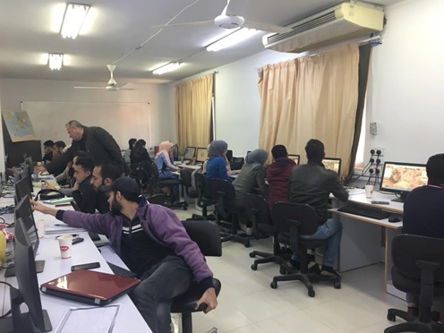
The GIS Laboratory offers integrated services in geographical informatics, supporting research in Cultural Heritage Management and Archaeological Excavations.
- Primary Goal: To collect, analyze, and present spatial data to support vital sectors.
- Infrastructure: Equipped with 20 high-performance computer units.
- Software: Utilizes ArcGIS, the global leader in spatial data management.
- Services: Digital map production, advanced spatial analysis, and specialized training courses.
II. Ground Penetrating Radar (GPR)
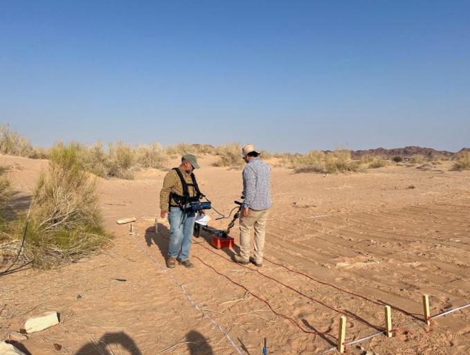
The GPR is a non-destructive geophysical tool that uses radar pulses to image the subsurface. It is essential for detecting buried structures and utilities.
- Mechanism: Transmits radar pulses to detect differences in electrical properties.
- Archaeology: Pinpointing buried artifacts without excavation.
- Civil Engineering: Detecting water pipes and electrical cables.
- Coverage: Survey area up to 1000 square meters (One Dunum).
"Yarmouk University will not bear any additional costs related to the surveying operation."
Service Cost: 500 JOD per plot (1 Dunum)
Contact Information

Mr. Mahmoud Alwan (Lab Technician)